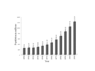
चित्र:Percent of scheduled tribes in India-tehsils-census 2011.svg

Size of this PNG preview of this SVG file: ६१८ × ६०० पिक्सेल. इतर resolutions: २४७ × २४० पिक्सेल | ४९५ × ४८० पिक्सेल | ७९१ × ७६८ पिक्सेल | १,०५५ × १,०२४ पिक्सेल | २,११० × २,०४८ पिक्सेल | २,२६८ × २,२०१ पिक्सेल.
मूळ संचिका (SVG संचिका, साधारणपणे २,२६८ × २,२०१ pixels, संचिकेचा आकार: ७.१ मे.बा.)
संचिकेचा इतिहास
संचिकेची त्यावेळची आवृत्ती बघण्यासाठी त्या दिनांक/वेळेवर टिचकी द्या.
| दिनांक/वेळ | छोटे चित्र | आकार | सदस्य | प्रतिक्रीया | |
|---|---|---|---|---|---|
| सद्य | १७:४५, २७ जानेवारी २०२४ |  | २,२६८ × २,२०१ (७.१ मे.बा.) | Goran tek-en | {{Information |description ={{en|Percent of scheduled tribes in India by tehsils by census 2011}} {{Institution |wikidata=Q668}} {{Institution |wikidata=Q1861882}} |date =2024-01-27 |source ={{Own based|Inda states districts tehsils by census 2011.svg|Percent of scheduled tribes in India by tehsils by census 2011.png|Maps template-en.svg|BlankMap-World gray.svgb1=Goran tek-en|b2=Kaiyr|b3=Sting|b4=LivingShadow}} <br> *Requested by and knowledge from {{U|Kaiyr}} |auth... |
दुवे
खालील पाने या संचिकेला जोडली आहेत:
जागतिक संचिका उपयोग
संचिकाचे इतर विकिपीडियावरील वापरः
- ar.wikipedia.org वरील उपयोग
- as.wikipedia.org वरील उपयोग
- az.wikipedia.org वरील उपयोग
- bh.wikipedia.org वरील उपयोग
- bn.wikipedia.org वरील उपयोग
- ca.wikipedia.org वरील उपयोग
- de.wikipedia.org वरील उपयोग
- el.wikipedia.org वरील उपयोग
- en.wikipedia.org वरील उपयोग
- eo.wikipedia.org वरील उपयोग
- es.wikipedia.org वरील उपयोग
- et.wikipedia.org वरील उपयोग
- fi.wikipedia.org वरील उपयोग
- fr.wikipedia.org वरील उपयोग
- gu.wikipedia.org वरील उपयोग
- he.wikipedia.org वरील उपयोग
- hi.wikipedia.org वरील उपयोग
- it.wikipedia.org वरील उपयोग
- ja.wikipedia.org वरील उपयोग
- kn.wikipedia.org वरील उपयोग
- ko.wikipedia.org वरील उपयोग
- lt.wikipedia.org वरील उपयोग
- lv.wikipedia.org वरील उपयोग
- ml.wikipedia.org वरील उपयोग
- nl.wikipedia.org वरील उपयोग
- nn.wikipedia.org वरील उपयोग
- or.wikipedia.org वरील उपयोग
- pnb.wikipedia.org वरील उपयोग
- pt.wikipedia.org वरील उपयोग
- ru.wikipedia.org वरील उपयोग
- sat.wikipedia.org वरील उपयोग
- sa.wikipedia.org वरील उपयोग
- simple.wikipedia.org वरील उपयोग
- sq.wikipedia.org वरील उपयोग
- sv.wikipedia.org वरील उपयोग
- ta.wikipedia.org वरील उपयोग
या संचिकेचे अधिक वैश्विक उपयोग पहा


