चित्र:Map of Russia - Tyumen Oblast, Yamalo-Nenets and Khanty-Mansi Autonomous Okrugs (2008-03).svg

Size of this PNG preview of this SVG file: ८०० × ४६२ पिक्सेल. इतर resolutions: ३२० × १८५ पिक्सेल | ६४० × ३६९ पिक्सेल | १,०२४ × ५९१ पिक्सेल | १,२८० × ७३८ पिक्सेल | २,५६० × १,४७७ पिक्सेल | १,०९२ × ६३० पिक्सेल.
मूळ संचिका (SVG संचिका, साधारणपणे १,०९२ × ६३० pixels, संचिकेचा आकार: २०९ कि.बा.)
.svg)
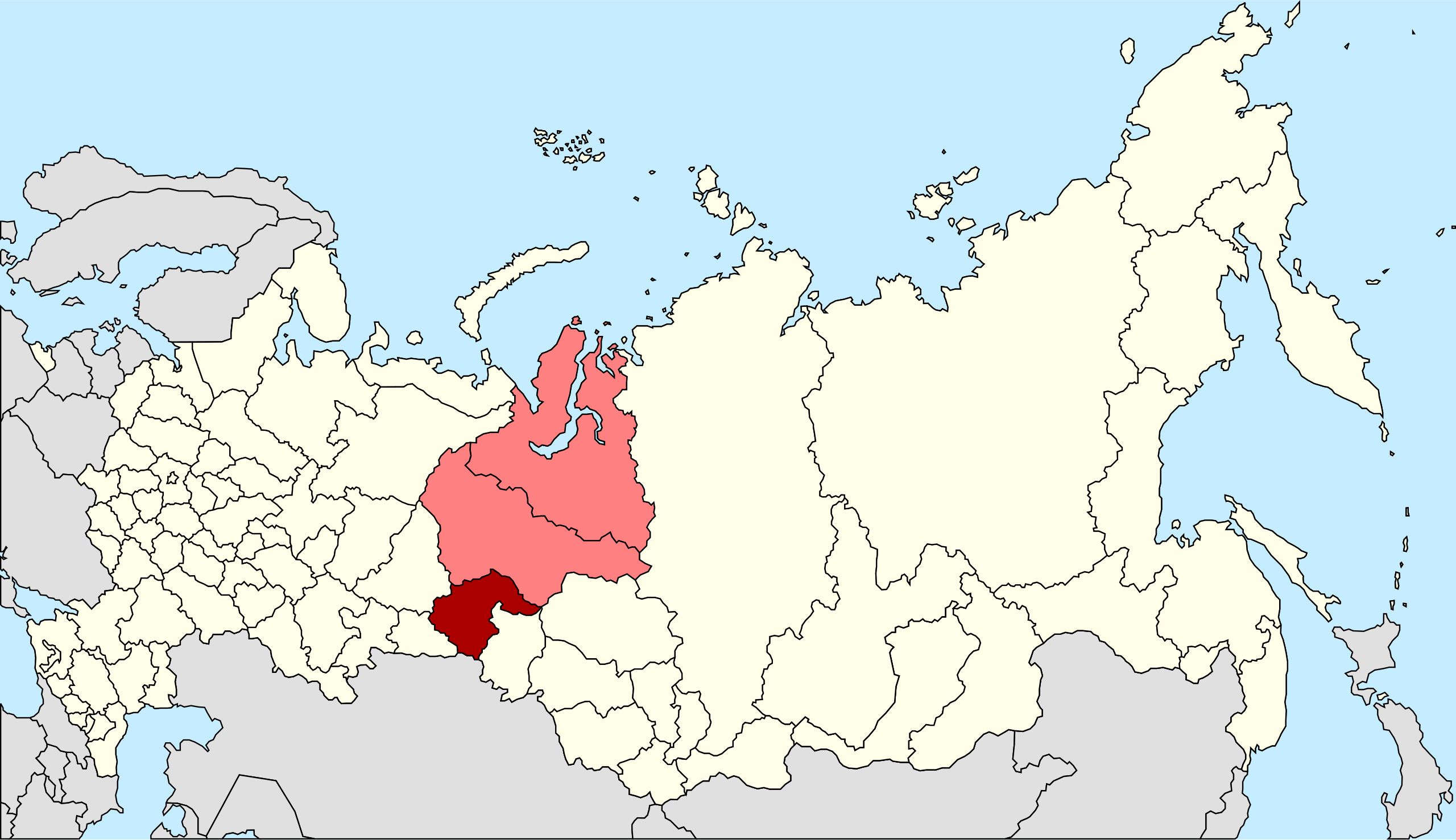
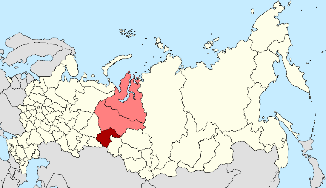
| वर्णन | Autogenerated image to indicate Russian subjects as of 2008-03. Tyumen Oblast and the Yamalo-Nenets and Khanty-Mansi Autonomous Okrugs since these are subordinated to Tyumen Oblast. |
| दिनांक | |
| स्रोत | Made from Image:Map of Russian subjects, 2008-03-01.svg |
| लेखक | Marmelad |
| परवानगी (या संचिकेचा पुनर्वापर करीत आहे) |
Attribution ShareAlike 2.5 |
| इतर आवृत्तींस | Tyumen Oblast only, Khanty-Mansi Autonomous Okrug only, Yamalo-Nenets Autonomous Okrug only. |
.svg)
.svg)
.svg)
ही संचिका खालील परवान्याअंतर्गत आहे - क्रीएटिव्ह कॉमन्स Attribution-Share Alike 2.5 Generic.
- तुम्ही मुक्त आहात.
- सामायिक करा – नक्कल, वितरण आणि पारेषित करण्यास
- पुर्नमिश्रीत करण्यास – काम गरजेनुसार अनुकुलीत करण्यास
- खालील अटींच्या अधिन राहून:
- रोपण – आपण योग्य क्रेडिट देणे आवश्यक आहे, परवान्यास दुवा प्रदान करणे आवश्यक आहे, आणि बदल केले गेले आहेत हे दर्शविणे आवश्यक आहे. आपण हे कोणत्याही वाजवी मार्गाने करू शकता, परंतु परवानाधारक आपल्यास किंवा आपल्या वापरास मान्यता देतो अशा कोणत्याही मार्गाने नाही.
- जसेहोते-वाटातसेच (शेअर अलाईक) – जर तुम्ही या कामात काही बदल केलात, काटछाट केलीत, किंवा भर घातली, तर असे करून बनलेले नवीन काम तुम्ही केवळ या किंवा यासारख्याच परवान्याअंतर्गत प्रसारित करू शकतात.
संचिकेचा इतिहास
संचिकेची त्यावेळची आवृत्ती बघण्यासाठी त्या दिनांक/वेळेवर टिचकी द्या.
| दिनांक/वेळ | छोटे चित्र | आकार | सदस्य | प्रतिक्रीया | |
|---|---|---|---|---|---|
| सद्य | ०१:११, २८ मे २०१४ | | १,०९२ × ६३० (२०९ कि.बा.) | Knyaz-1988 | New version |
| ०१:१०, २८ मे २०१४ |  | १,०९२ × ६३० (२२२ कि.बा.) | Knyaz-1988 | Reverted to version as of 00:06, 1 March 2008 | |
| २२:५१, ४ फेब्रुवारी २०१० |  | १,०९२ × ६३० (२०८ कि.बा.) | Виктор В | new color | |
| ०५:३६, १ मार्च २००८ |  | १,०९२ × ६३० (२२२ कि.बा.) | Lokal Profil | {{Information |Description=Autogenerated image to indicate Russian subjects as of 2008-03. Tyumen Oblast and the Yamalo-Nenets and Khanty-Mansi Autonomous Okrugs since these are subordinated to Tyumen Oblast. |Source=Made from [[:Image:Map of Russian subj |
दुवे
खालील पाने या संचिकेला जोडली आहेत:
जागतिक संचिका उपयोग
संचिकाचे इतर विकिपीडियावरील वापरः
- be-tarask.wikipedia.org वरील उपयोग
- be.wikipedia.org वरील उपयोग
- bs.wikipedia.org वरील उपयोग
- eo.wikipedia.org वरील उपयोग
- fa.wikipedia.org वरील उपयोग
- fr.wikipedia.org वरील उपयोग
- nl.wikipedia.org वरील उपयोग
- pl.wikipedia.org वरील उपयोग
- pnb.wikipedia.org वरील उपयोग
- ru.wikipedia.org वरील उपयोग
- ru.wikinews.org वरील उपयोग
- sv.wikipedia.org वरील उपयोग
- tr.wikipedia.org वरील उपयोग
- uk.wikipedia.org वरील उपयोग
- xmf.wikipedia.org वरील उपयोग
.svg)