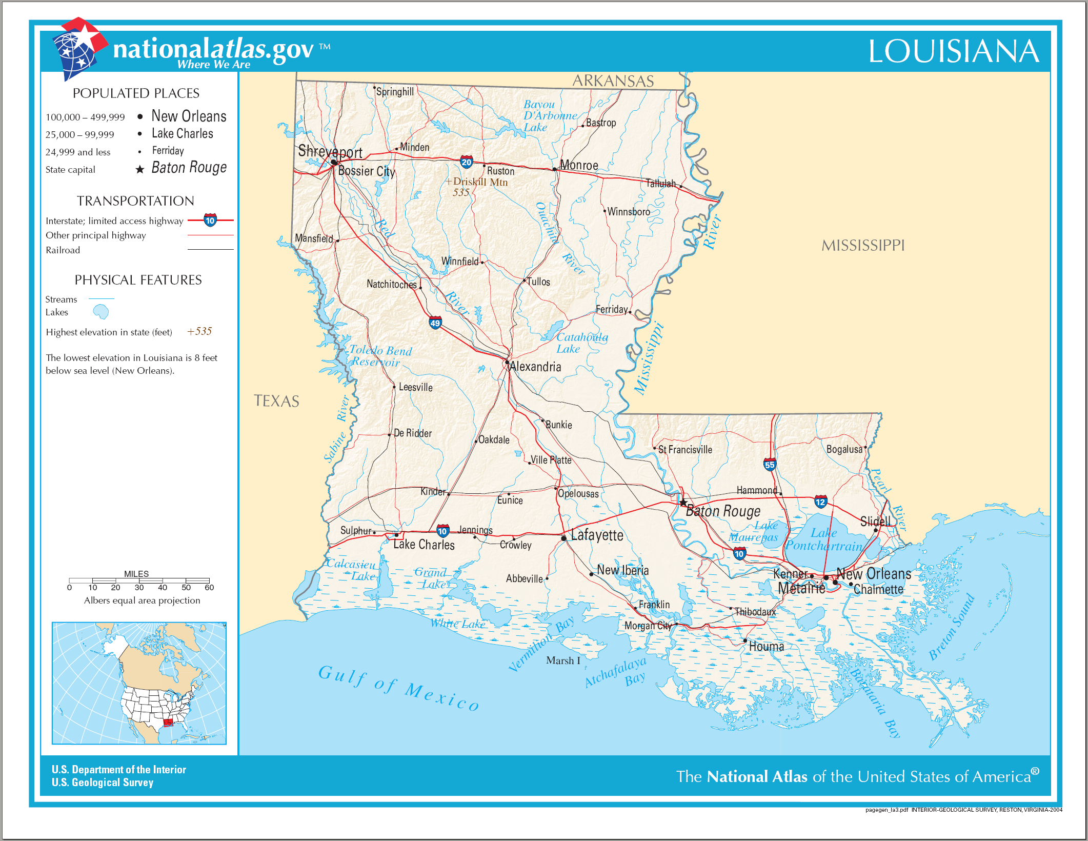
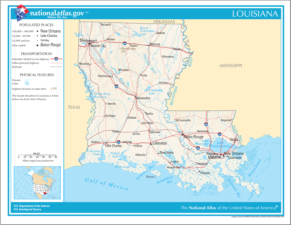
चित्र:Map of Louisiana NA.png
या झलकेचा आकार: ७७६ × ६०० पिक्सेल पिक्सेल. इतर resolutions: ३११ × २४० पिक्सेल | ६२१ × ४८० पिक्सेल | ९९४ × ७६८ पिक्सेल | १,२८० × ९८९ पिक्सेल | २,१२२ × १,६४० पिक्सेल.
मूळ संचिका (२,१२२ × १,६४० पिक्सेल, संचिकेचा आकार: १.७८ मे.बा., MIME प्रकार: image/png)
सारांश
| वर्णन | Map of Louisiana |
| दिनांक | |
| स्रोत | National Atlas |
| लेखक |
परवाना:
This map was obtained from an edition of the National Atlas of the United States. Like almost all works of the U.S. federal government, works from the National Atlas are in the public domain in the United States.
Online access: NationalAtlas.gov | 1970 print edition: Library of Congress, Perry-Castañeda Library
|
संचिकेचा इतिहास
संचिकेची त्यावेळची आवृत्ती बघण्यासाठी त्या दिनांक/वेळेवर टिचकी द्या.
| दिनांक/वेळ | छोटे चित्र | आकार | सदस्य | प्रतिक्रीया | |
|---|---|---|---|---|---|
| सद्य | ०२:३०, १५ ऑगस्ट २००६ | | २,१२२ × १,६४० (१.७८ मे.बा.) | Huebi~commonswiki | {{Information| |Description=Map of Louisiana |Source=[http://www.nationalatlas.gov National Atlas] }} Category:Maps of the United States Category:Maps of Louisiana {{PD-USGov-Atlas}} |
दुवे
खालील पाने या संचिकेला जोडली आहेत:
जागतिक संचिका उपयोग
संचिकाचे इतर विकिपीडियावरील वापरः
- de.wikipedia.org वरील उपयोग
- en.wikipedia.org वरील उपयोग
- fr.wikipedia.org वरील उपयोग
- hsb.wikipedia.org वरील उपयोग
- hu.wikipedia.org वरील उपयोग
- incubator.wikimedia.org वरील उपयोग
- it.wikipedia.org वरील उपयोग
- lt.wikipedia.org वरील उपयोग
- stq.wikipedia.org वरील उपयोग
- szl.wikipedia.org वरील उपयोग
- zea.wikipedia.org वरील उपयोग