चित्र:Karte Ephesos MKL1888.png
यापेक्षा मोठे चित्र उपलब्ध नाही.
Karte_Ephesos_MKL1888.png (४७४ × ४३२ पिक्सेल, संचिकेचा आकार: ४१ कि.बा., MIME प्रकार: image/png)
सारांश
| वर्णन | |
| दिनांक | |
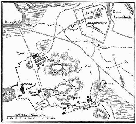
| स्रोत | Encyclopedia: Meyers Konversationslexikon (MKL) |
| लेखक | MKL cartographers |
परवाना:
| This image comes from the 4th edition of Meyers Konversationslexikon (1885–90). The copyrights have expired and this image is in the public domain. |
|
This work is in the public domain in its country of origin and other countries and areas where the copyright term is the author's life plus 100 years or fewer. This work is in the public domain in the United States because it was published (or registered with the U.S. Copyright Office) before January 1, 1929. | |
| This file has been identified as being free of known restrictions under copyright law, including all related and neighboring rights. | |
संचिकेचा इतिहास
संचिकेची त्यावेळची आवृत्ती बघण्यासाठी त्या दिनांक/वेळेवर टिचकी द्या.
| दिनांक/वेळ | छोटे चित्र | आकार | सदस्य | प्रतिक्रीया | |
|---|---|---|---|---|---|
| सद्य | २३:३७, १२ डिसेंबर २००४ | | ४७४ × ४३२ (४१ कि.बा.) | ¡0-8-15! | {{PD-Meyers}} |
दुवे
खालील पाने या संचिकेला जोडली आहेत:
जागतिक संचिका उपयोग
संचिकाचे इतर विकिपीडियावरील वापरः
- ar.wikipedia.org वरील उपयोग
- be-tarask.wikipedia.org वरील उपयोग
- be.wikipedia.org वरील उपयोग
- bg.wikipedia.org वरील उपयोग
- ca.wikipedia.org वरील उपयोग
- cs.wikipedia.org वरील उपयोग
- da.wikipedia.org वरील उपयोग
- de.wikipedia.org वरील उपयोग
- en.wikipedia.org वरील उपयोग
- es.wikipedia.org वरील उपयोग
- fr.wikipedia.org वरील उपयोग
- gl.wikipedia.org वरील उपयोग
- hi.wikipedia.org वरील उपयोग
- hr.wikipedia.org वरील उपयोग
- hy.wikipedia.org वरील उपयोग
- it.wikipedia.org वरील उपयोग
- it.wikivoyage.org वरील उपयोग
- jv.wikipedia.org वरील उपयोग
- la.wikipedia.org वरील उपयोग
- mk.wikipedia.org वरील उपयोग
- mt.wikipedia.org वरील उपयोग
- ru.wikipedia.org वरील उपयोग
- sl.wikipedia.org वरील उपयोग
- stq.wikipedia.org वरील उपयोग
- sw.wikipedia.org वरील उपयोग
- uk.wikipedia.org वरील उपयोग
- vi.wikipedia.org वरील उपयोग