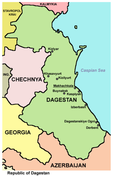
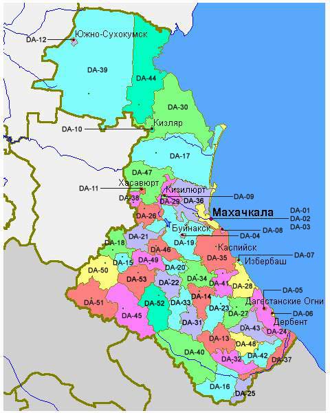
चित्र:Dagestan.png

या झलकेचा आकार: ३८४ × ५९९ पिक्सेल पिक्सेल. इतर resolutions: १५४ × २४० पिक्सेल | ४९२ × ७६८ पिक्सेल.
मूळ संचिका (४९२ × ७६८ पिक्सेल, संचिकेचा आकार: ३९ कि.बा., MIME प्रकार: image/png)
सारांश
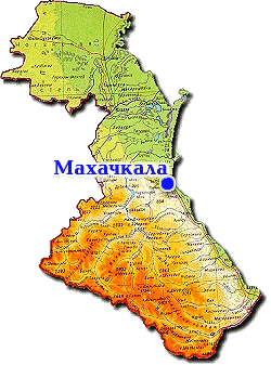
- Map of Dagestan.
Source and license

|
This map has been uploaded by Electionworld from en.wikipedia.org to enable the |
Map made by PANONIAN
| This work has been released into the public domain by its author, PANONIAN. This applies worldwide. असे करणे काही देशांमधे कायद्यानुसार शक्य नसू शकते. असे असल्यास : |
References
Maps from external links:
- http://img0.liveinternet.ru/images/attach/c/2//69/489/69489713_1295508808_dagestan_map1.jpg
- http://rense.com/general82/k01.gif
- http://www.rdaward.org/map/6w.jpg
- http://map.rin.ru/maps_e/Dagestan.gif
- http://map-site.narod.ru/dagestan-1.jpg
- http://russiaprofile.org/p-38660-cur_image.ajax?media_id=3836&_=1295947741 archive copy at the Wayback Machine
- http://img.blogcu.com/uploads/hhosoyagaci_dagistan_map.jpg
- http://static.ddmcdn.com/gif/willow/geography-of-dagestan0.gif archive copy at the Wayback Machine
- http://openbudget.karelia.ru/budnord/russian/north-caucasian/dagestan-republic/images/karta_dagestan.jpg
- http://www.mapzones.com/citymap/russia/republic_of_daghestan/republic_of_daghestan.jpg
- http://cdn4.spiegel.de/images/image-115997-thumbflex-oruu.jpg archive copy at the Wayback Machine
- http://www.martinfrost.ws/htmlfiles/may2009/geography-dagestan.jpg archive copy at the Wayback Machine
- http://www.exovera.com/sites/default/files/styles/large/public/field/image/dagestan%20map.jpg archive copy at the Wayback Machine
- http://worldgeo.ru/rmaps/reg05m.gif
- http://www-tc.pbs.org/wnet/need-to-know/files/2010/08/Map-Dagestan.gif
List of largest cities and towns:
- http://world-gazetteer.com/wg.php?x=&men=gcis&lng=en&des=wg&geo=-183&srt=npan&col=abcdefghinoq&msz=1500&geo=-3104[dead link]
संचिकेचा इतिहास
संचिकेची त्यावेळची आवृत्ती बघण्यासाठी त्या दिनांक/वेळेवर टिचकी द्या.
| दिनांक/वेळ | छोटे चित्र | आकार | सदस्य | प्रतिक्रीया | |
|---|---|---|---|---|---|
| सद्य | ०३:४४, ११ जून २०१२ | | ४९२ × ७६८ (३९ कि.बा.) | PANONIAN | {{Information |Description ={{en|1=improved version}} |Source =improved version |Author =improved version |Date = |Permission = |other_versions = }} |
| २१:३९, २९ डिसेंबर २००६ |  | ४१९ × ६०१ (१९ कि.बा.) | Electionworld | {{ew|en|PANONIAN}} Map made by PANONIAN {{PD-user|PANONIAN}} Category:Maps of the Russian republics |
दुवे
या चित्राशी जोडलेली पृष्ठे नाहीत.
जागतिक संचिका उपयोग
संचिकाचे इतर विकिपीडियावरील वापरः
- it.wikinews.org वरील उपयोग
- pl.wikinews.org वरील उपयोग
- ta.wikinews.org वरील उपयोग