चित्र:Colonisation2.gif

मूळ संचिका (१,८४९ × ८१० पिक्सेल, संचिकेचा आकार: २.०८ मे.बा., MIME प्रकार: image/gif, विळख्यात सापडलेले, १२ चौकटी, ४८से)
सारांश
| वर्णन |
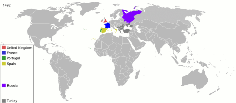
English: Map indicating the territories colonized by the European powers, United States and Japan.
Русский: Карта с указанием территорий, колонизированных Европейскими державами, Соединёнными штатами и Японией.
|
||||||||||||||||
| दिनांक | जून २३, इ.स. २००८ (original upload date) | ||||||||||||||||
| स्रोत | ने en.wikipedia पासून कॉमन्सवर हस्तांतरित केले. | ||||||||||||||||
| लेखक | ArdadN at इंग्रजी विकिपीडिया | ||||||||||||||||
| इतर आवृत्तींस |
The maps can be seen separately by using this template:
Derivative works of this file: |
||||||||||||||||
.gif)
.jpg)
._LOC_2001620596.jpg)
परवाना:
| I, the copyright holder of this work, release this work into the public domain. This applies worldwide. असे करणे काही देशांमधे कायद्यानुसार शक्य नसू शकते. असे असल्यास : मी कोणालाही कोणत्याही कारणासाठी हे काम वापरण्याचे अधिकार कोणत्याही बंधनाशिवाय जर अशी बंधने कायद्याने बंधनकारक नसतीलतर देत आहोत. |
संचिकेचा इतिहास
संचिकेची त्यावेळची आवृत्ती बघण्यासाठी त्या दिनांक/वेळेवर टिचकी द्या.
| दिनांक/वेळ | छोटे चित्र | आकार | सदस्य | प्रतिक्रीया | |
|---|---|---|---|---|---|
| सद्य | २१:१०, ५ ऑक्टोबर २०२० | | १,८४९ × ८१० (२.०८ मे.बा.) | Ориенталист | Colour correction |
| १९:४९, १० मे २०२० |  | ८०० × ३७९ (६०६ कि.बा.) | Ориенталист | Cosmetic changes | |
| १५:०९, ५ एप्रिल २०२० |  | ८०० × ३५१ (५६१ कि.बा.) | Ориенталист | Last time i forgot 1914. Аdded it, little changes | |
| १५:१९, ४ एप्रिल २०२० |  | ८०० × ३५१ (४९५ कि.बा.) | Ориенталист | Changed maps for 1492, 1550, 1660, 1754. Added a map for 1600. | |
| १६:५९, ९ जानेवारी २०१९ |  | १,४२५ × ६२५ (१०१ कि.बा.) | ArdadN | fixed Ireland 1754, Morocco 1914, Russian-German border 1885 and 1914, German-French border 1885 and 1914, German-Danish border 1885, Austria and Sudetenland 1938 | |
| १४:२४, २३ जुलै २०१८ |  | १,४२५ × ६२५ (१०१ कि.बा.) | SuperSucker | fix - believe in 1938 ethiopia was under european occupation as well.. italy had taken the capital Addis-Abeba in 1936 indeed | |
| ०१:५७, ५ जून २०१२ |  | १,४२५ × ६२५ (१०१ कि.बा.) | Mnlk | i corrected the error that falsly depicted ethiopia as colony of fascist italy | |
| ०१:१९, २० फेब्रुवारी २०११ |  | १,४२५ × ६२५ (२४६ कि.बा.) | NordNordWest | corrected according to http://de.wikipedia.org/w/index.php?title=Benutzer_Diskussion%3ANordNordWest&action=historysubmit&diff=85468547&oldid=85447379 | |
| ०१:१०, १९ फेब्रुवारी २०११ |  | १,४२५ × ६२५ (२३६ कि.बा.) | NordNordWest | corrected according to http://de.wikipedia.org/w/index.php?title=Benutzer_Diskussion%3ANordNordWest&action=historysubmit&diff=85447379&oldid=85351900 | |
| ०१:१२, १७ सप्टेंबर २०१० |  | १,४२५ × ६२५ (२५७ कि.बा.) | NordNordWest | further corrections |
दुवे
या चित्राशी जोडलेली पृष्ठे नाहीत.
जागतिक संचिका उपयोग
संचिकाचे इतर विकिपीडियावरील वापरः
- ar.wikipedia.org वरील उपयोग
- av.wikipedia.org वरील उपयोग
- azb.wikipedia.org वरील उपयोग
- az.wikipedia.org वरील उपयोग
- ba.wikipedia.org वरील उपयोग
- be-tarask.wikipedia.org वरील उपयोग
- be.wikipedia.org वरील उपयोग
- bg.wikipedia.org वरील उपयोग
- bn.wikipedia.org वरील उपयोग
- ce.wikipedia.org वरील उपयोग
- cs.wikipedia.org वरील उपयोग
- da.wikipedia.org वरील उपयोग
- de.wikipedia.org वरील उपयोग
- diq.wikipedia.org वरील उपयोग
- en.wikipedia.org वरील उपयोग
- History of Europe
- Early modern period
- Maritime history
- Colonial empire
- History of colonialism
- User:Palaeovia
- Portal:Maps/Maps/World
- Portal:Maps/Maps/World/18
- History of globalization
- User talk:AtomAtom
- Western world
- User:Meclee/proj4-sandbox
- User:Kazkaskazkasako/Books/History
- Outline of globalization
- Decoloniality
- Wikipedia:Graphics Lab/Map workshop/Archive/Apr 2014
- User:Bongan
- User:Bongan/genetic history of the human race
- en.wikibooks.org वरील उपयोग
या संचिकेचे अधिक वैश्विक उपयोग पहा