मूळ संचिका(SVG संचिका, साधारणपणे २५४ × २५४ pixels, संचिकेचा आकार: ३४२ कि.बा.)

Render this image in .

ही संचिका Wikimedia Commons येथील असून ती इतर प्रकल्पात वापरलेली असू शकते. तिचे तेथील संचिका वर्णन पान खाली दाखवले आहे.

सारांश

वर्णन
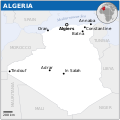
English: Locator map of Algeria.
दिनांक
स्रोत
English: Algeria Locator Map (ReliefWeb), ESRI, UNCS
लेखक
SVG genesis
InfoField
 
The SVG code is valid.
 
This map was created with Inkscape.
 
 This map uses embedded text that can be easily translated using a text editor.


परवाना:

w:en:Creative Commons
रोपण
ही संचिका खालील परवान्याअंतर्गत आहे - क्रीएटिव्ह कॉमन्स Attribution 3.0 Unported.
रोपण: OCHA
तुम्ही मुक्त आहात.
  • सामायिक करा – नक्कल, वितरण आणि पारेषित करण्यास
  • पुर्नमिश्रीत करण्यास – काम गरजेनुसार अनुकुलीत करण्यास
खालील अटींच्या अधिन राहून:
  • रोपण – आपण योग्य क्रेडिट देणे आवश्यक आहे, परवान्यास दुवा प्रदान करणे आवश्यक आहे, आणि बदल केले गेले आहेत हे दर्शविणे आवश्यक आहे. आपण हे कोणत्याही वाजवी मार्गाने करू शकता, परंतु परवानाधारक आपल्यास किंवा आपल्या वापरास मान्यता देतो अशा कोणत्याही मार्गाने नाही.
This map is part of a collection of 216 free country maps, created by the UN Office for the Coordination of Humanitarian Affairs (OCHA), to be used in print, web or broadcast products.

The ReliefWeb Location Maps released here are maps that highlight a country, its capital, major populated places and the surrounding regions.

Attribution Requirements

Using the map without modifications: ensure that the sources and the disclaimer are below the map. Credit as follows: "Credit: OCHA".

For use with alteration: remove the OCHA logo and disclaimer following any modification to the map, but keep the data sources as mentioned below the map. Credit the modified map as follows: "Based on OCHA map". You are responsible for the content of your map.

We are keen to receive your feedback and hear how you used OCHA's maps. We would be grateful if you would notify us by e-mail and share your work with us.

UN Disclaimer
The designations employed and the presentation of material of this map do not imply the expression of any opinion whatsoever on the part of the Secretariat of the United Nations concerning the legal status of any country, territory, city or area or of its authorities or concerning the delimitation of its frontiers or boundaries.
VRT Wikimedia

हे काम विनामूल्य आहे आणि कोणत्याही हेतूसाठी कोणीही वापरला जाऊ शकतो. आपण ही सामग्री वापरू इच्छित असल्यास, आपण या पृष्ठावर उल्लेख केलेल्या कोणत्याही परवाना अटींचे पालन करीत असताना परवानगीची विनंती करण्याची आवश्यकता नाही.

या पृष्ठावर उल्लेख केलेल्या अटींनुसार कॉपीराइट धारकाने प्रकाशनास मंजुरी दिली असल्याची खात्री करुन विकिमीडियाला ई-मेल प्राप्त झाला आहे. हे पत्रव्यवहार एक VRTS सदस्याद्वारे पुनरावलोकन केले गेले आहे आणि आमच्या परवानगी संग्रहण मध्ये संग्रहित केले आहे. पत्रव्यवहार विश्वासार्ह स्वयंसेवकांना  ticket #2014031410007248 म्हणून उपलब्ध आहे.

जर संग्रहित पत्रव्यवहाराविषयी आपल्याला प्रश्न असल्यास, कृपया VRT नोटिसबोर्ड वापरा. Ticket link: https://ticket.wikimedia.org/otrs/index.pl?Action=AgentTicketZoom&TicketNumber=2014031410007248
Find other files from the same ticket: SDC query (SPARQL)

Captions

Add a one-line explanation of what this file represents

Items portrayed in this file

depicts इंग्रजी

copyright status इंग्रजी

copyrighted इंग्रजी

checksum इंग्रजी

4e9506463362bdb7077016635dd664e01da5ab58

data size इंग्रजी

३,४९,७२० byte

२५४ चित्रपेशी

२५४ चित्रपेशी

संचिकेचा इतिहास

संचिकेची त्यावेळची आवृत्ती बघण्यासाठी त्या दिनांक/वेळेवर टिचकी द्या.

दिनांक/वेळछोटे चित्रआकारसदस्यप्रतिक्रीया
सद्य०६:०३, १९ नोव्हेंबर २०२२०६:०३, १९ नोव्हेंबर २०२२ आवृत्तीसाठी छोटे चित्र२५४ × २५४ (३४२ कि.बा.)Pengetik-AMFile uploaded using svgtranslate tool (https://svgtranslate.toolforge.org/). Added translation for id.
२१:४६, १ मार्च २०२१२१:४६, १ मार्च २०२१ आवृत्तीसाठी छोटे चित्र२५४ × २५४ (३४० कि.बा.)Trần Nguyễn Minh HuyFile uploaded using svgtranslate tool (https://svgtranslate.toolforge.org/). Added translation for vi.
२१:१७, ३० ऑक्टोबर २०१४२१:१७, ३० ऑक्टोबर २०१४ आवृत्तीसाठी छोटे चित्र२५४ × २५४ (३४२ कि.बा.)Daylon124Removed watermark.
०५:५०, २१ एप्रिल २०१४०५:५०, २१ एप्रिल २०१४ आवृत्तीसाठी छोटे चित्र२५४ × २५४ (३८५ कि.बा.)UN OCHA maps bot== {{int:filedesc}} == {{Information |description={{en|1=Locator map of Algeria.}} |date=2013 |source={{en|1=[http://reliefweb.int/map/algeria/algeria-location-map-2013 Algeria Locator Map (ReliefWeb)]}} |author={{en|1=[[w:en:United Na...

खालील पाने या संचिकेला जोडली आहेत:

जागतिक संचिका उपयोग

संचिकाचे इतर विकिपीडियावरील वापरः

मेटाडाटा