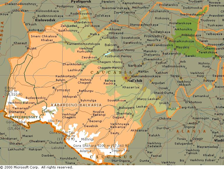
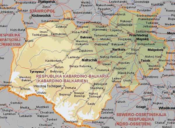
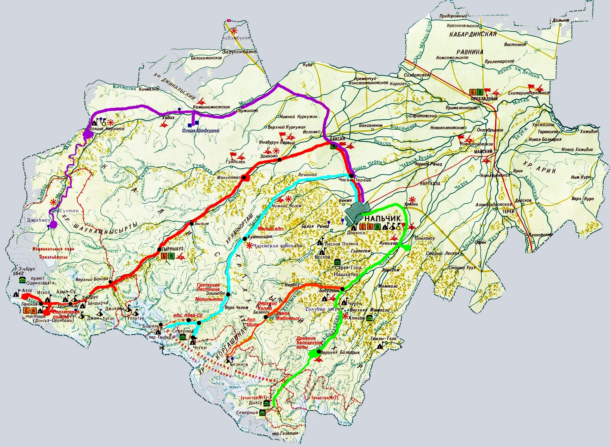
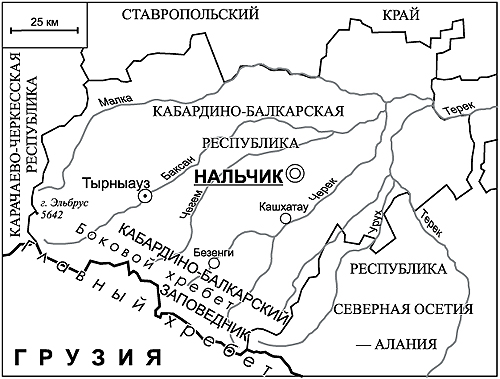
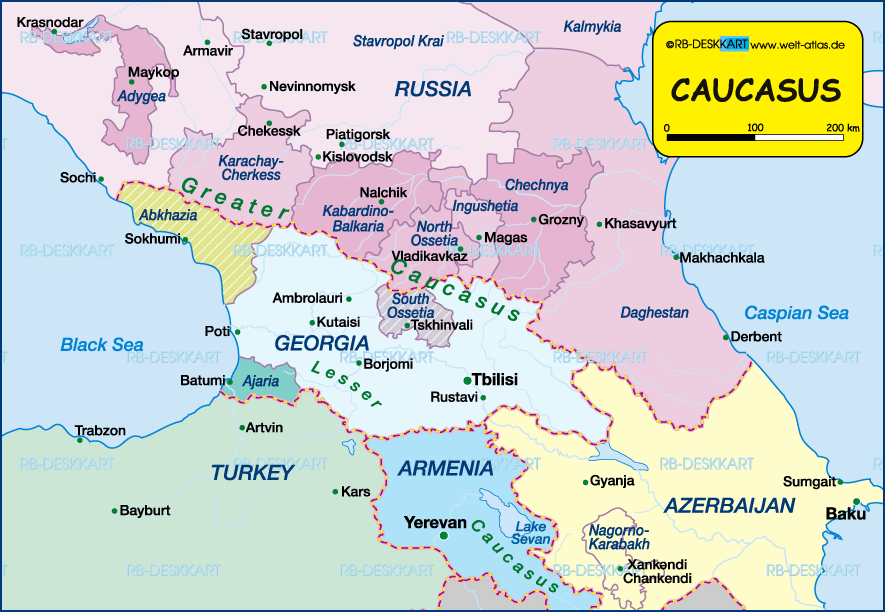
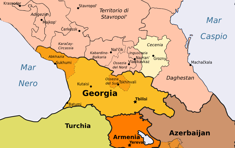
चित्र:Kabardino Balkaria Republic map.png

या झलकेचा आकार: ७६७ × ६०० पिक्सेल पिक्सेल. इतर resolutions: ३०७ × २४० पिक्सेल | ६१४ × ४८० पिक्सेल | ९१२ × ७१३ पिक्सेल.
मूळ संचिका (९१२ × ७१३ पिक्सेल, संचिकेचा आकार: ६२ कि.बा., MIME प्रकार: image/png)
सारांश
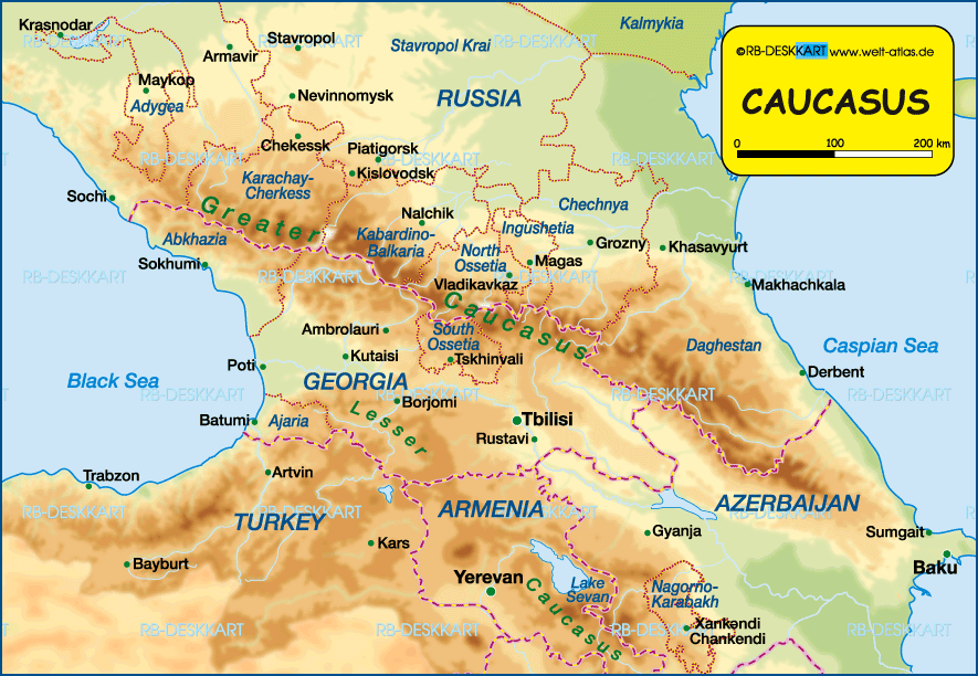
| वर्णन | Map of Kabardino-Balkaria Republic, Russia. |
| दिनांक | |
| स्रोत | स्वतःचे काम |
| लेखक | PANONIAN |
| इतर आवृत्तींस | Derivative works of this file: Kabardsko-balkarská republika.png |
परवाना:
I, the copyright holder of this work, hereby publish it under the following license:
| This file is made available under the Creative Commons CC0 1.0 Universal Public Domain Dedication. | |
| The person who associated a work with this deed has dedicated the work to the public domain by waiving all of their rights to the work worldwide under copyright law, including all related and neighboring rights, to the extent allowed by law. You can copy, modify, distribute and perform the work, even for commercial purposes, all without asking permission.
|
References
Maps from external links:
- http://www.circassianworld.com/Maps/07kb.jpg
- http://www.kabardinobalkarskayarsp.ru/images/kabardino_balkariya_map(1).jpeg
- http://www.rgo-speleo.ru/plans/GLACKIPR/Kabardino_Balkarija.jpg
- http://www.nonhores.com/img/ministerrus/rus07-map.jpg
- http://russiaprofile.org/p-38660-cur_image.ajax?media_id=3863&_=1295954338
- http://russiatrek.org/images/map/kabardino-balkaria-republic-map.gif
- http://www.ntsomz.ru/img/kabardino-balkariya_800x566.jpg
- http://www.circassianworld.com/kabardino.jpg
- http://www.museum.com.ua/project/club/otkritki/russia/map/kabardino_balkaria.jpg
- http://www.mapzones.com/citymap/russia/kabardino_balkaryan_republi/nalchik.jpg
- http://www.paeo.de/region/russia/region2/kabard1.jpg
- http://www.karta-russia.ru/maps/map-kabardino-balkarskaya-karta.jpg
- http://dic.academic.ru/pictures/enc_geo/Kabardino-Balkaria.jpg
- http://www.aquaexpert.ru/id_pict/region_21.gif
- http://goroder.ru/wp-content/uploads/2011/12/karta_dorog_kabardino_balkarii.jpg
- http://geo.1september.ru/2009/02/9-1.jpg
- http://s012.radikal.ru/i319/1101/58/8e5915d8b380.jpg
- http://s005.radikal.ru/i209/1101/51/95d98311bf37.jpg
- http://www.welt-atlas.de/datenbank/karten/en/karte-4-966-en.gif
- http://geograficamente.files.wordpress.com/2010/04/caucaso.jpg
- http://www.welt-atlas.de/datenbank/karten/en/karte-4-965-en.gif
.jpeg)
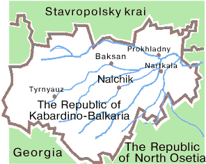
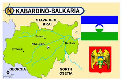
Largest cities and towns in Kabardino-Balkaria:
संचिकेचा इतिहास
संचिकेची त्यावेळची आवृत्ती बघण्यासाठी त्या दिनांक/वेळेवर टिचकी द्या.
| दिनांक/वेळ | छोटे चित्र | आकार | सदस्य | प्रतिक्रीया | |
|---|---|---|---|---|---|
| सद्य | १९:४७, २१ फेब्रुवारी २०२३ | | ९१२ × ७१३ (६२ कि.बा.) | Shibbolet3579 | Even if international law and the UN count less nowadays, we differentiate the international border from the limits of the autonomous republics |
| १९:१८, १३ ऑगस्ट २०१२ |  | ९१२ × ७१३ (४७ कि.बा.) | PANONIAN | {{Information |Description=Map of Kabardino-Balkaria Republic, Russia. |Source={{own}} |Date=2012 |Author= PANONIAN |Permission= |other_versions= }} |
दुवे
खालील पाने या संचिकेला जोडली आहेत:
जागतिक संचिका उपयोग
संचिकाचे इतर विकिपीडियावरील वापरः
- ace.wikipedia.org वरील उपयोग
- ar.wikipedia.org वरील उपयोग
- arz.wikipedia.org वरील उपयोग
- bs.wikipedia.org वरील उपयोग
- ceb.wikipedia.org वरील उपयोग
- cv.wikipedia.org वरील उपयोग
- diq.wikipedia.org वरील उपयोग
- en.wikipedia.org वरील उपयोग
- eo.wikipedia.org वरील उपयोग
- frr.wikipedia.org वरील उपयोग
- fr.wikipedia.org वरील उपयोग
- ga.wikipedia.org वरील उपयोग
- hr.wikipedia.org वरील उपयोग
- hy.wikipedia.org वरील उपयोग
- it.wikipedia.org वरील उपयोग
- ja.wikipedia.org वरील उपयोग
- ka.wikipedia.org वरील उपयोग
- kbd.wikipedia.org वरील उपयोग
- kk.wikipedia.org वरील उपयोग
- lez.wikipedia.org वरील उपयोग
- mk.wikipedia.org वरील उपयोग
- ms.wikipedia.org वरील उपयोग
- mzn.wikipedia.org वरील उपयोग
- nl.wikipedia.org वरील उपयोग
- no.wikipedia.org वरील उपयोग
- pnb.wikipedia.org वरील उपयोग
- pt.wikipedia.org वरील उपयोग
- sco.wikipedia.org वरील उपयोग
- se.wikipedia.org वरील उपयोग
- sh.wikipedia.org वरील उपयोग
- sk.wikipedia.org वरील उपयोग
- sl.wikipedia.org वरील उपयोग
- sr.wikipedia.org वरील उपयोग
- su.wikipedia.org वरील उपयोग
- sv.wikipedia.org वरील उपयोग
- ta.wikipedia.org वरील उपयोग
- tr.wikipedia.org वरील उपयोग
या संचिकेचे अधिक वैश्विक उपयोग पहा